Alberta, Canada publishes Atlas of deep geothermal energy potential
Launch of the Geothermal Atlas of Alberta (source: Alberta Geological Survey) The Alberta Geological Survey has published the Geothermal Atlas
Read more
Alternative Energy Resource Video
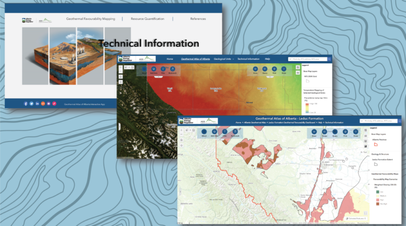
Launch of the Geothermal Atlas of Alberta (source: Alberta Geological Survey) The Alberta Geological Survey has published the Geothermal Atlas
Read more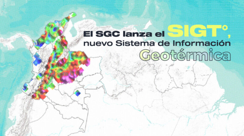
Launch of the Geothermal Information System / Sistema de Información Geotérmica (SIGT°) by the Colombian Geological Service – Geothermal Research
Read more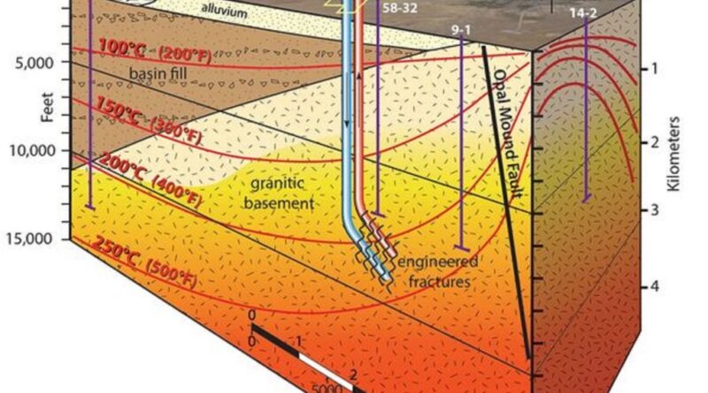
Conceptual model of the Utah FORGE project (source: Utah FORGE) The Utah FORGE project has published a Wiki dashboard to
Read more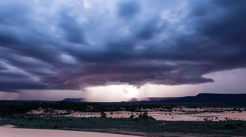
Jalapão State Park, Tocantins, Brazil (source: Bart van Dorp / flickr, Creative Commons) The research of Lacasse et al (2022)
Read more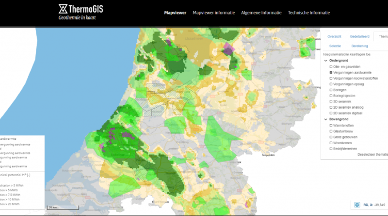
Screenshot of the ThermoGIS web-based GIS platform (source: ThermoGIS) Version 2.2 of ThermoGIS, the web-based GIS tool for estimating geothermal
Read more
Petit Bras de Seine, Issy-les-Moulineaux, Paris/ France (source: flickr/ Guilhem Vellut, creative commons) The multidisciplinary hazard map developed by BRGM
Read more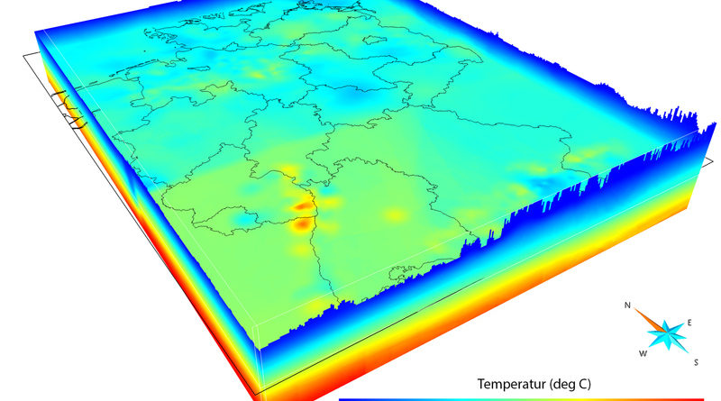
3D temperature map of Germany with a depth of 2000 meters. (source: Thorsten Agemar / LIAG) The Geothermal Information System
Read more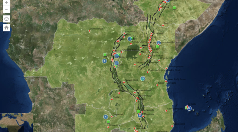
Africa Geothermal Inventory Database, GIS map view (screenshot) UNEP in Nairobi, Kenya is seeking to hire a Geographic Information Systems
Read more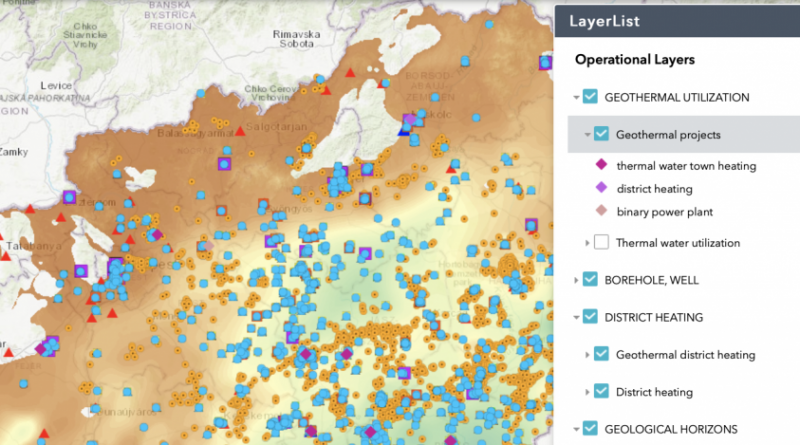
As part of its the GeoConnect³d blog the Horizon 2020 EU-funded GeoERA programme, shared an interesting post on the Hungarian Geothermal System,
Read moreYou may also be interested in these posts: