Swiss 3D seismic breakthrough: A game-changer for geothermal exploration
Energy Disrupter
A case study of a seismic survey in Eclépens, Switzerland highlights the importance of high-density 3D seismic data in improving decision-making in geothermal.
The success of a recent 3D seismic survey in Western Switzerland underlines the importance of high-quality seismic data for geothermal exploration. This pilot project around the town of Eclépens in the canton of Vaud could show a more secure and efficient path to developing geothermal energy and increasing the impact geothermal energy has on the green energy market.
Precision exploration tools as an enabler for geothermal growth
Global interest in geothermal energy for both heat and electricity is rapidly increasing. 88 countries currently produce heat from geothermal sources and 29 countries have geothermal electricity plants (Geothermie Swiss, 2024), however the impact that geothermal energy has on the total energy market is minimal.
Identifying potential geothermal resources and pinpointing optimal exploratory drilling locations remains the challenging dimension to successful geothermal exploitation. Multiple abandoned attempts to harness geothermal energy can be linked to lack of knowledge of the subsurface which results in wasting time and money and diminishing public support for future projects.
Careful planning and implementing of detailed seismic surveys in the early stages of geothermal projects gives the crucial insight needed for stakeholders to advance confidently with real data in hand to support decision-making. This is acutely important in Europe where geothermal exploration and development has particular constraints linked to dense urbanisation, strict government permitting, and often strong local community objections.
Europe is still heavily dependent on gas, oil and nuclear power to reach its increased winter energy demands that cannot be entirely covered by the intermittent energy supplied by wind or solar. Geothermal solutions exist to fill this gap, linking in with existing local energy providers and district heating projects. These projects are reliant, however, on finding geothermal reservoirs with precise conditions and properties adapted to energy production. With recent advances in seismic technology, high-resolution, dense seismic surveys are helping kick-start future geothermal projects all over Europe, providing a lower-cost method for acquiring a high-quality image of the subsurface.
A Case Study in Eclépens, Western Switzerland
Much of the Swiss plateau has been earmarked for its geothermal potential. While the regional geology is well known, there are very few areas that have been subject to detailed subsurface investigations. Potential medium depth geothermal targets in the sedimentary layers of the Molasse basin are intersected by zones of faults, fractures and shearing which were created as sedimentary layers in the Swiss plateau were pushed up against the Jura mountains.
Understanding the amplitude and orientation of faults, fractures, and geological features, as well as specific properties affecting geothermal brine flow and temperature, such as porosity and permeability, is essential for planning well location and trajectory. Detailed geological modelling using high -resolution, 3D seismic surveys combined with existing well log data and surface geology features, is an essential tool for interpreting the subsurface and planning geothermal projects.
In the search for potential geothermal resources, the area around Eclépens, in the canton of Vaud was selected as a target survey area after strong geothermal indicators were detected in the 1981 Eclépens-1 well (M. Baykulov et al., 2024). An unusually high geothermal gradient was detected in the well, with temperatures above 100 °C at depths of 2000m, which indicates a potential geothermal resource that could provide not only energy for district heating systems but also geothermal electricity production. Legacy 2D seismic survey data already existed in the area but did not provide enough detail for accurate planning and execution of preliminary geothermal well placement.
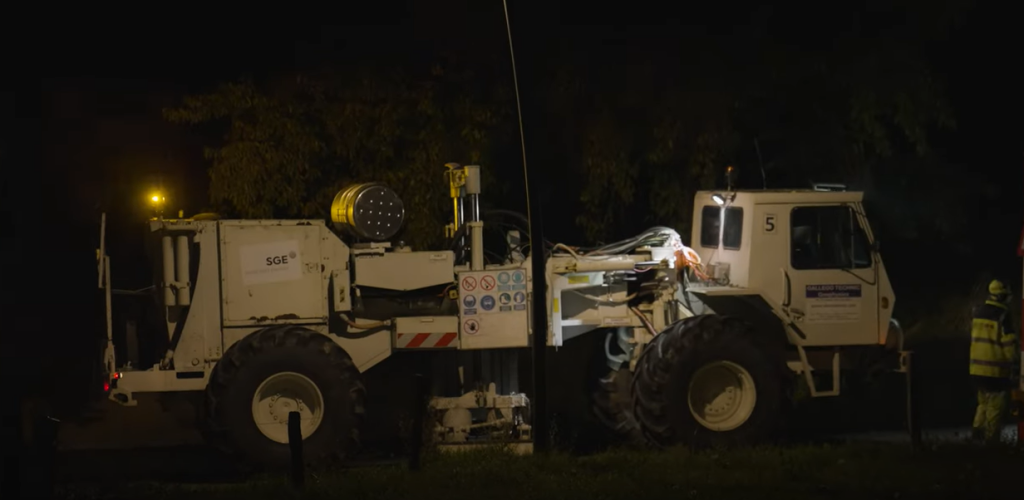
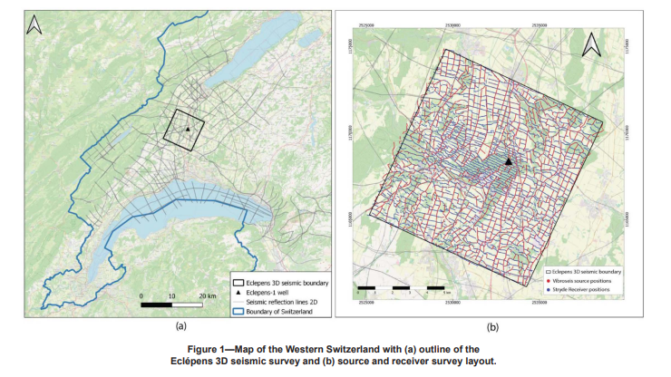
Swiss Geo Energy’s pioneering 3D seismic acquisition project for geothermal energy is one of the world’s densest 3D surveys acquired for geothermal purposes, with a trace density of 2 million trace/km2. The survey covered an area of 104 km2 and aimed at producing cost efficient and high-quality data sets, with deep geological penetration and high vertical and horizontal resolution. By filling in the existing sparse 2D seismic data from the Eclépens area with high-quality 3D data sets the resulting modeling of the subsurface geology will be used to help identify reservoir targets and provide an estimation of the geothermal resources (M. Baykulov et al., 2024).
The survey proper
The survey includes 3 major stages:
- Planning and Permitting
A thorough planning and permitting stage was carried out to ensure a consequent smooth and rapid acquisition process. This results in lower impact to the community and environment, higher efficiency and therefore lower costs. As well as receiving all required licensing and permits from the local and regional authorities, the contractors worked with private, agricultural and industrial landowners to facilitate land access during the acquisition process.
Diligent planning of the seismic source and receiver layout was undertaken to achieve optimal coverage of the area and preserve the density of the acquired traces. A theoretical, preliminary grid layout was designed taking in consideration the tectonic fault lines described in earlier, regional models and oriented so that the fault lines could be optimally imaged (M. Baykulov et al., 2024). This theoretical grid was then significantly adjusted to real-life conditions using GIS software to account for obstacles in the landscape and no-permit zones.
The seismic acquisition contractor, Geo2X, chose STRYDE autonomous nodes for the seismic survey. These nodes are the smallest and lightest seismic receiver nodes on the market, a revolution that not only delivers cost benefits but also greatly changes the way seismic surveys are carried out.
STRYDE has developed a streamlined node, small enough to fit in the palm of your hand and stripped of redundant components. These small, lightweight receivers enabled the survey to be conducted with minimal impact to the environment and local community because of the reduced equipment burden and the ease of deployment on foot or with smaller vehicles. The use of lightweight, cable-free nodes also increases trace density as the number of nodes deployed is easily increased around obstacles or target areas with little change to acquisition time or team size.
- Seismic Survey Acquisition
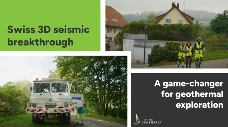
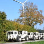
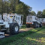
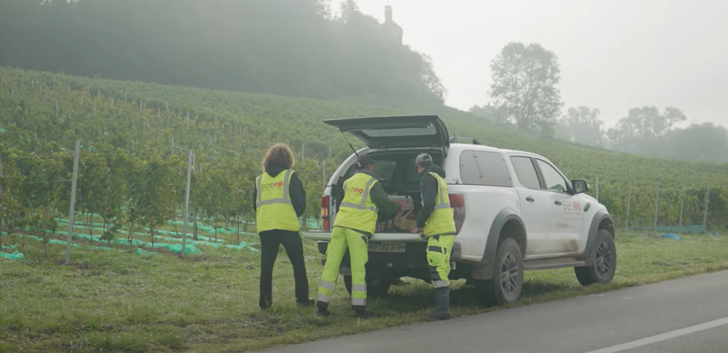
A total of 21,475 individual STRYDE autonomous nodes were deployed by Geo2X at the Eclépens site over 11 days following the pre-planned orthogonal source and receiver grid layout. The area was split into four team quadrants with one vibroseis truck working in each quadrant. Careful attention was applied to the distance between sources (to avoid interference) and the vibration levels in proximity to buildings (as per the Swiss regulations).
The simplicity of STRYDE nodes and their consequent recording reliability and robustness results in minimal field quality controls. These nodes have precise time synchronization and GNSS positioning and have done away with redundant and unnecessary capabilities that relay live information to the field team during the survey – a hangover from the days of fragile, cabled systems and sparse survey spacing where any data gaps were an impediment to survey results.
The reliability of the STRYDE nodes means that, once deployed and synched, they do not need to be tracked in the field. In contrast, seismic receivers that relay data to the field team in real-time are more expensive, bulkier, need more battery life and have more components susceptible to malfunction. In the Eclépens survey, 99% of data was recovered from the STRYDE nodes (M. Baykulov et al., 2024) and material loss or damage was minimal.
Preliminary assessment of the data can be carried out when the nodes are harvested or redeployed. Data QCs can be performed on preliminary data sets using specialized, on-site software components. STRYDE’s streamlined node harvesting systems and unique in-field software processing tools allow for rapid turnover of node acquisition and deployment and a reliable first look at data while operations are continuing. This process has replaced the redundant, in-field QC process of bulky real time geophones which gave limited, positioning information and reflection data without any processing capabilities.
To achieve the high channel count required for dense, 3D, urban surveys, large numbers of receiver nodes need to be deployed across often complicated urban areas. The risk of receivers being lost, damaged or tampered with is higher in urban areas and can result in incomplete data sets or added delays and cost increases to the project, this is regardless of real-time QC or tracking seen on bigger and more costly geophone systems.
STRYDE is known for its low node loss record, with very small numbers of deployed nodes missing through tampering, theft or damage. The compact size of the STRYDE node allows it to be easily buried or hidden and therefore not obvious to passersby. The node loss count for the Eclépens survey was less than 2 % and did not impact data continuity. The small size of the nodes also means that they are highly mobile, easily carried on foot with streamlined deployment and retrieval using smaller crew sizes. This flexibility was beneficial in a survey area like Eclépens with complicated mixed-purpose urban and agricultural areas and limited heavy vehicle access.
- Data Processing, Interpretation and Well Placement
Fast-track processing of the acquired data sets gave an early overview of the quality of the data and enabled comparisons to the regional macro-structures and the legacy 2D data sets. The data went through preliminary conditioning techniques which include noise reduction, signal enhancement, and correction for any data inconsistencies. This ensures that the data sets are of the highest quality before further, more sophisticated processing.
A first-look, comparative analysis of pre-STM data imaging already showed the enhanced detail of the 2023 3D data set, compared with the vintage 2D seismic images with reduced seismic noise, less chaotic signatures and more continuity in reflectors. Comparison of the NW-SE linear 2D line with an identical spatial line from the new data showed the lack of continuity in seismic reflectors of the 2D data and an overall chaotic signature (M. Baykulov et al., 2024).
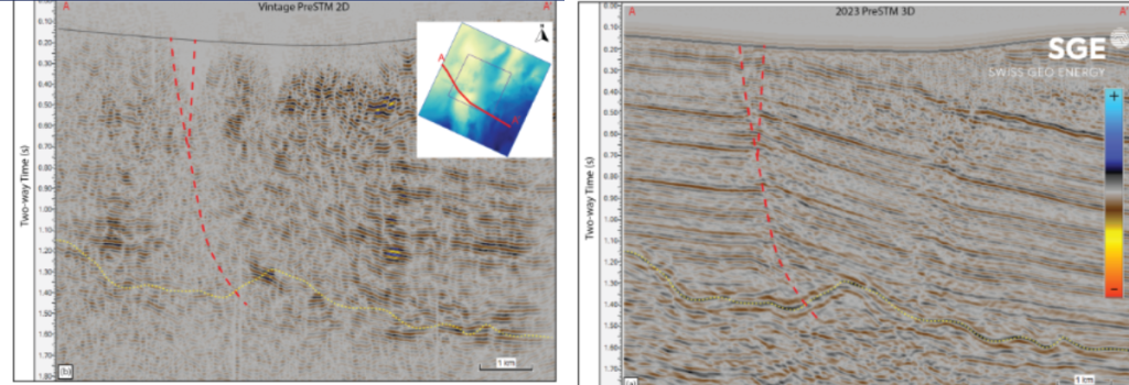
Common urban obstacles such as roads and buildings limit the acquisition of straight line 2D seismic. 3D surveys, however, can combine information from all directions with many different source-receiver combinations which can work around obstacles or voids in the survey area. Given the high volume and density of the data, data gaps can also be compensated by advanced interpolation techniques during data processing.
Thanks to the high resolution of the seismic signal obtained in the Eclépens survey, a series of sophisticated data processing techniques were applied to the dataset in order to produce a more complete and accurate seismic model of the area. These techniques include, for example, Full-Waveform Inversion (FWI), Common Reflection Angle Migration (CRAM), rock property inversion and Reverse Time migration (RTM) which help to further refine the seismic image and enhance subsurface characterisation.
By integrating the processed seismic survey data with existing well log data, detailed and accurate 3D geological models can be produced. The final models are key project management tools that are essential to decision making for well location, trajectory, depth etc. These models provide the best possible estimation of the target resource and are key in supporting all aspects of geothermal projects, from planning to engineering, mitigating risks and project cost reduction.
Conclusions
The benefits of high-density, 3D seismic surveys have already been extensively exploited in other industries such as petroleum, nuclear waste storage, mineral exploration, etc. The Eclépens case study shows how seismic reflection surveys can be performed to high industry standards, with high-quality data sets and streamlined operational performance, while keeping acquisition costs low enough to benefit the renewable energy industry.
These surveys add real value to geothermal exploration projects by bringing more clarity to the subsurface and aiding decision-making. High-resolution geological models from dense 3D geophysical surveys are the most robust tools available to evaluate the target resource and plan well locations and trajectories.
Through a combination of thorough and diligent planning and permitting stages along with advanced seismic acquisition technology such as the STRYDE receiver node, it is now possible to bring high-density, 3D surveys to the geothermal market.

