Alberta, Canada publishes Atlas of deep geothermal energy potential
Energy Disrupter
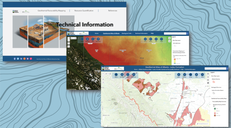
The Alberta Geological Survey has published the Geothermal Atlas of Alberta, Canada highlighting key insights on the deep geothermal potential of the region.
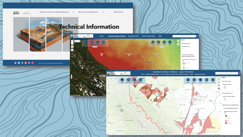
The Alberta Geological Survey (AGS) has published the Geothermal Atlas of Albeta, a public, web-based geographic information system (GIS) application that provides geoscience data and information relevant to the assessment deep geothermal energy potential in Alberta, Canada.
The Geothermal Atlas of Alberta can be accessed via this link.
The tool is designed to support the exploration and development of geothermal resources in Alberta by providing key information and capabilities including the following:
- Relevant geoscience data for exploring geothermal energy below the base of groundwater protection.
- Key insights into formation’s temperature, pore volume, and fluid presence.
- A technical information website detailing methodologies and techniques.
- The ability to query depth, thickness, and temperature at specific locations.
- Geological and geothermal statistics at the legal subdivision (LSD) scale.
- Identification of geologically favorable areas for potential conventional geothermal development.
- A help widget to assist users in navigating the Atlas.
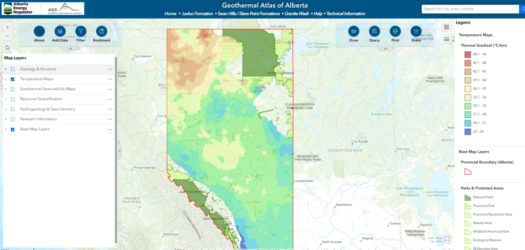
The Geothermal Atlas also shows the regional geothermal energy potential of specific geological units in Alberta. The geothermal potential was estimated using a deterministic (well-based) resource quantification approach developed at the Alberta Geological Survey (AGS) by adapting the widely accepted and standardized USGS volumetric method to the one-dimensional (i.e., well) scale. Additionally, the geothermal potential was estimated using the USGS volumetric method with probability distributions, factoring in reservoir characteristics such as temperature, volume, porosity, specific heat capacity, and density.
There has been plenty of geothermal development activity in Alberta in recent years, mostly centering on geothermal greenhouse projects in Hinton and Rainbow Lake. Less than a month ago, the Government of Alberta announced an investment into the Alberta Drilling Accelerator, a test facility that will allow for the development of advanced drilling technologies that will serve the energy industry, including geothermal.
Source: Alberta Geological Survey

