
Web-based Geothermal Information System launched in Colombia
Energy Disrupter
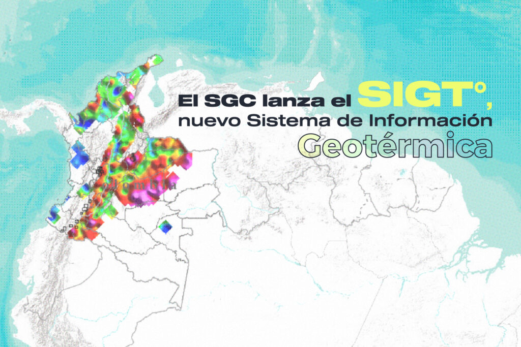
 Launch of the Geothermal Information System / Sistema de Información Geotérmica (SIGT°) by the Colombian Geological Service – Geothermal Research Group (source: SGC)
 The Colombian Geological Service has launched SIGT°, a GIS web-based tool that displays geothermal and other related information in Colombia.
The Colombian Geological Service (SGC) – Geothermal Research Group has launched the Geothermal Information System / Sistema de Información Geotérmica (SIGT°), an openly accessible, ArcGIS-based web tool that provides a host of information on the geothermal resources and potential of Colombia.
Click here to access the SIGT° tool.
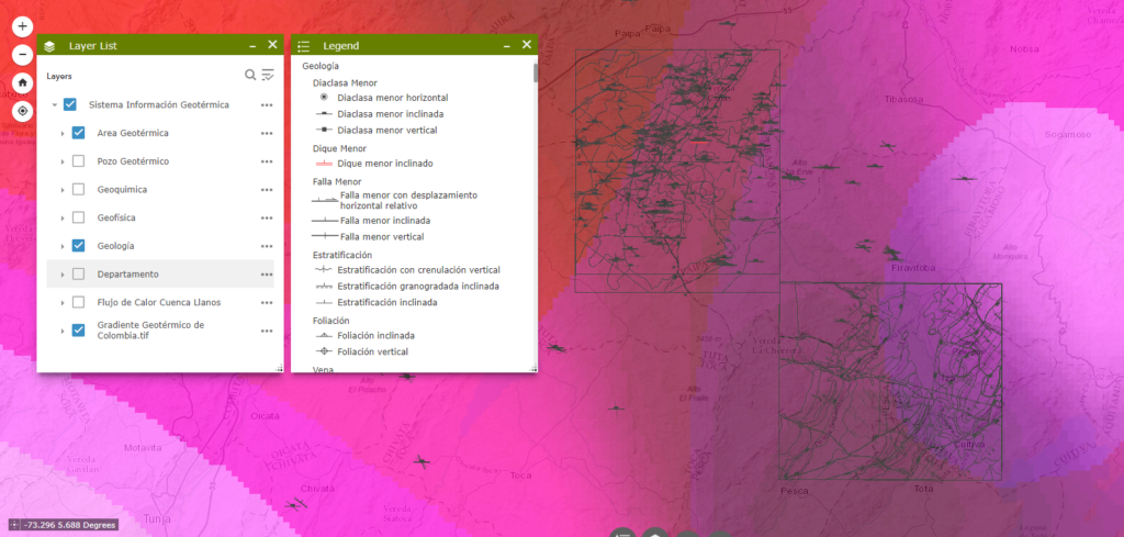
The SIGT° provides the locations of geothermal areas in the country as well as their respective geological, geophysical, and geochemical data. It also has information available on geothermal wells, geological units, and faults. This allows users to superimpose layers to see how the geothermal areas overlap with departments and municipalities.
The SIGTº also integrates other tools developed by the Geothermal Research Group, such as the dashboard for estimating Colombia’s geothermal potential (with data on fumaroles, volcanoes and geothermal areas), the National Inventory of Hydrothermal Manifestations, and chemical information on springs and fumaroles. It is important to emphasize that while this System is being used, its thematic information is being updated.
Earlier this year, Colombia’s National Hydrocarbon Agency had announced that the country will hold its first round of auctions for geothermal energy projects before year-end. The specific areas that will be put up for the tender have not been identified yet at the time, as this is an element that was still under study by the CGS.
Source: Colombian Geological Service
Related Posts:
 Geothermal information roadshow to travel across…
- Spanish Geothermal Assocation GEOENERGIA launched to…
- Colombia awards first-ever geothermal power project license
- Colombia establishes new regulations on geothermal…
- Nereidas geothermal project seen to strengthen…
- FindHeat consortium launched to develop new…
- Geo4all program launched to advance geothermal…
- EU URGENT project launched for urban seismic…


