Hungary’s interactive geothermal information platform
Energy Disrupter
As part of its the GeoConnect³d blog the Horizon 2020 EU-funded GeoERA programme, shared an interesting post on the Hungarian Geothermal System, an interactive geothermal information platform and its availability in English. GeoERA is an Horizon2020 EU funded programme, run by a consortium of 33 national and 15 regional geological survey organisations from Europe (see Parties) aimed at delivering a geological service for Europe.
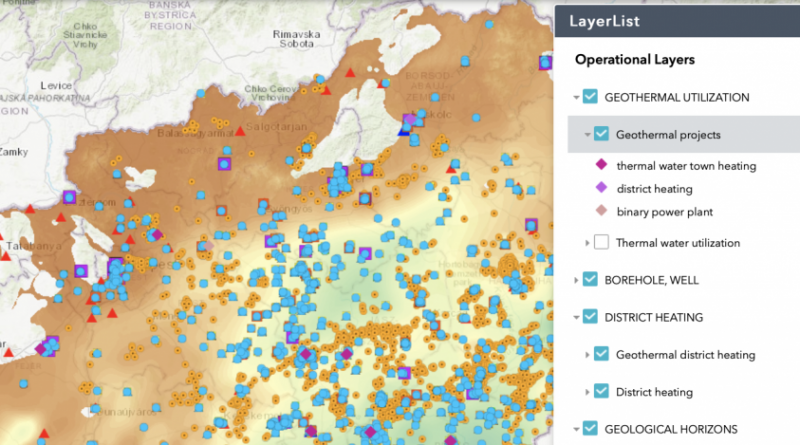
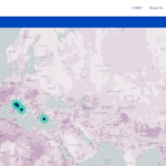
The Hungarian Geothermal System (OGRe) aims to provide up-to-date and reliable geological, hydrogeological and geophysical data and information about Hungary’s geothermal energy resources via a user-friendly and publicly accessible site.
In the article written by Annamaria Nador of the Mining and Geological Survey of Hungary (MBFSZ), it is written that there is the hope that this platform will help the preparatory work of national and international consortia aiming to invest into new geothermal projects in Hungary, as well as the every-day work of policy makers. Furthermore it aims to assist higher level education and also provide useful information to the public interested in geothermal energy.
The system is comprised of 2 parts: a web-map system and thematic modules.
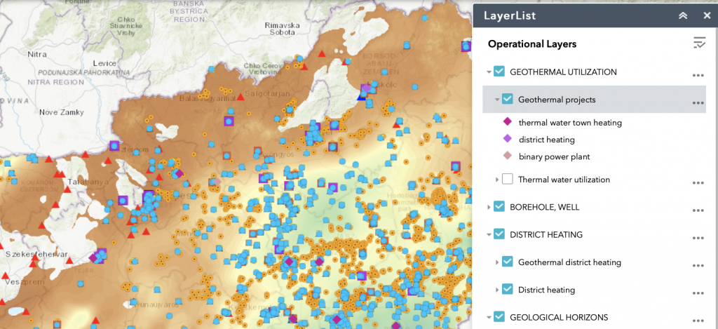
The web-map system is comprised of a set of maps edited for the territory of the entire country (e.g. geological horizons bounding the most important geothermal aquifers, isotherm maps characterizing the subsurface temperature conditions, maps showing the 3D spatial distribution of the most important geothermal reservoirs, etc.); point features (e.g. thermal water wells, boreholes, locations of geothermal projects, etc.) and polygons (e.g. thermal groundwater bodies, concessional areas, etc.). These are arranged into various thematic groups, which can be visualized up to request and can be combined with each other.
Maps presented on the portal are based on regional geoscientific models, therefore they provide a large-scale overview about the geothermal conditions of a certain territory; however they do not replacedetailed exploration and pre-feasibility study necessary for a concrete project at local scale.
Nevertheless with a detailed map series of geophysical coverage, as well as maps showing the location of boreholes deeper than 500 m, and hydrocarbon exploration wells, OGRe provides a unique opportunity to search for data for a certain territory for a detailed prospection. For further information and data, please visit the State Geological, Geophysical and Mining Data Store.
The different thematic groups and their specific layers generally show metadata. An exception is the group of thermal water wells, where the system provides detailed data of 1695 wells (e.g. depth of screened intervals, aquifer lithology, groundwater level, yield, temperature, hydrogeochemical character, utilization type, etc.). The other exception is the pilot area of the Borsod-Abaúj-Zemplén county, where the simplified lithostratigraphy of the boreholes and the images of the various geophysical measurements (e.g. 2D seismic lines, well-logs) are also available.
Building on the results of the DARLINGe project, OGRe also comprises 3 thematic modules, which provide assistance during the different stages of geothermal project development. The Benchmarking tool comprises 12 independent indicators to evaluate strengths and weaknesses of current thermal water management and utilization practice, regarding management (licensing and monitoring), technology and energy (operational and efficiency issues), environment (reinjection and over-exploitation), as well as social aspects. There is a calculation formula for each indicator and the results are grouped into one of five categories, pointing out how much efforts have to be taken to improve the current exploitation practice. The Decision Tree tool aims to educate the readers what kind of various decision gates might occur during the development of a geothermal project. The tool consists of 49 questions grouped into fields of (1) geothermal resources, (2) market, (3) licencing, and (4) funding. The answer of questions is a simple yes or no, and starts from the beginning of an ideal project and guides throughout all major project development phases, with decisions at major milestones. The Risk Mitigation tool aims to define those geological risk mitigation measures, by which highly probable damages can be avoided in a given project. First the tool is collecting information about the project along 4 subsequent questionnaires (general information, available data, reservoir properties, fluid properties). Then the given project phase should be selected, and the tool will list the suggested the relevant risk mitigation measures.
The team of the Mining and Geological Survey of Hungary appreciates any remark related to the content of the portal to be sent to: info@mbfsz.gov.hu!
